
Burlington County ZIP Code Directory Areas
The county has 40 municipalities, while postal delivery follows a different map. The working list below comes from ZIPs printed for Burlington municipal assessor offices in the state assessor-contact file, supplemented by county municipality and mailing addresses. It is a routing table, not proof that every street in a town uses one ZIP. USPS remains the delivery authority for a particular address, and the municipal assessor remains the source for situs and tax jurisdiction. That distinction matters most where a postal label reaches several towns or where an assessor's own mailing address uses a post office outside its municipality.
| ZIP | County areas represented | Postal name or area | Record-routing note |
|---|---|---|---|
| 08010 | Beverly City; Edgewater Park | Beverly area | Confirm the delivery point before selecting a custodian. |
| 08016 | Burlington City; Burlington Township | Burlington | One postal name serves both city and township. |
| 08019 | Woodland Township | Chatsworth | Rural and Pinelands postal geography. |
| 08022 | Mansfield Township | Columbus | Use the municipality for local records. |
| 08036 | Hainesport Township | Hainesport | Verify exact street delivery with USPS. |
| 08041 | Springfield Township | Jobstown | Postal label differs from the township name. |
| 08046 | Willingboro Township | Willingboro | Municipal parcel route applies. |
| 08048 | Lumberton Township | Lumberton | Municipal parcel route applies. |
| 08052 | Maple Shade Township | Maple Shade | Municipal parcel route applies. |
| 08053 | Evesham Township | Marlton | Marlton is the postal name, Evesham the municipality. |
| 08054 | Mount Laurel Township | Mount Laurel | Municipal parcel route applies. |
| 08055 | Medford Township; Medford Lakes Borough | Medford | Shared postal geography. |
| 08057 | Moorestown Township | Moorestown | Municipal parcel route applies. |
| 08060 | Eastampton; Mount Holly; Westampton | Mount Holly area | One ZIP reaches three municipalities. |
| 08065 | Palmyra Borough | Palmyra | Municipal parcel route applies. |
| 08068 | Pemberton Borough; Pemberton Township | Pemberton | Legal municipality still controls local files. |
| 08075 | Delanco; Delran; Riverside | Shared postal area | Resolve town before searching records. |
| 08077 | Cinnaminson Township; Riverton Borough | Riverton/Cinnaminson | Shared postal geography. |
| 08088 | Shamong; Southampton; Tabernacle | Rural and Pinelands area | Several municipalities use this postal area. |
| 08215 | Washington Township assessor mailing address | Egg Harbor | Out-of-area post office does not change situs. |
| 08224 | Bass River Township assessor mailing address | New Gretna | Out-of-area postal identity appears in official contacts. |
| 08505 | Bordentown City/Township; Fieldsboro | Shared postal area | Postal geography crosses town lines. |
| 08511 | New Hanover Township | Cookstown | Postal label differs from township name. |
| 08518 | Florence Township | Florence | Municipal parcel route applies. |
| 08562 | North Hanover; Wrightstown | Wrightstown | Resolve the municipality before a records request. |
| 08620 | Chesterfield Township assessor mailing address | Trenton | Postal designation is not the municipality. |
Two additional labels require direct confirmation rather than assumption: 08011 is a Birmingham or remote rural locality not printed in the current assessor-contact list, and 08015 is associated by a state program with Burlington County although the assessor contact uses Pemberton/08068. The same source identifies 08001 as Alloway in Salem County, so it is not a Burlington County coverage area.
Burlington County Postal Names and Legal Towns
A ZIP can narrow a search, but it cannot replace the municipality. Marlton is the delivery name for Evesham Township. The 08060 area can direct mail through Eastampton, Mount Holly, or Westampton. The same problem appears at 08075 for Delanco, Delran, and Riverside, at 08077 for Cinnaminson and Riverton, and at 08088 for Shamong, Southampton, and Tabernacle. Burlington County's mix of river towns, suburban corridors, and rural Pinelands communities makes these crossovers normal rather than exceptional.
Record systems use different keys. The municipal assessor keeps the parcel card by taxing municipality, the County Clerk's PRESS system uses recorded-document keys, and NJGIN routes statewide parcel research by address, county, municipality, block, and lot. A postal city on a letter or a mailing address is a useful lead, but the legal municipality should travel with every search note. That practice avoids mixing two streets with similar names or attaching a property file to a neighboring town merely because the delivery label is familiar.
Note: A ZIP association in an office address is evidence for routing, not a statement that all delivery points in that municipality use the same postal area.
Verify a Burlington County ZIP Before Record Searches
Use the exact address as the starting point. The USPS lookup accepts a residential or corporate street address with city and state, or a street and ZIP, and returns a standardized delivery format. New Jersey's municipality lookup then helps translate that address into its legal municipality. From there, NJGIN address points and parcel data can supply the county, municipality, block, lot, lot qualifier, or PIN needed for the county and municipal records systems.
- Check the street address with the USPS ZIP Lookup, recording the standardized form instead of relying on a casual postal name.
- Enter the address in the New Jersey municipality lookup to identify the municipality tied to the location.
- Use NJGIN address or parcel resources to obtain the parcel identifiers when a property record is needed.
- Take the municipality and block-and-lot result to the municipal assessor or to PRESS for the appropriate period of recorded documents.
- For a voter-registration question, use the name-led state portal or contact the Board of Elections. The inspected voter form was not a ZIP-wide browse tool.
The New Jersey municipality lookup is shown below. Its result is the bridge between a delivery label and the legal place that holds local property material.
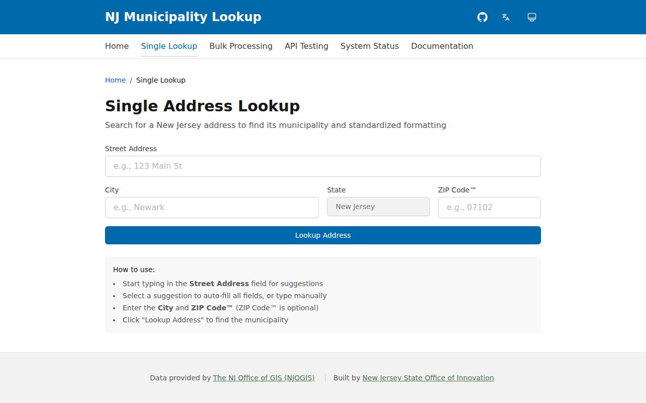
That municipal result should be kept beside the postal result, especially for Marlton, Cookstown, and other delivery names that differ from the municipal record keeper.
Burlington County ZIP Code Directory Fields
The state municipality tool is a documented ZIP-capable portal, unlike PRESS, which did not show ZIP as a search field during inspection. Its small field set makes it a useful first screen when a postal label and a municipality do not agree. NJGIN then uses address, county, municipality, block, and lot for parcel work; hosted owner names in its statewide parcel data are redacted under Daniel's Law.
| Field | Form and role | Use in the route |
|---|---|---|
| Street Address | Autocomplete | Supplies the specific delivery point for a municipality result. |
| City | Text field | Tests the entered postal city against the standardized address. |
| State | State field | Sets the New Jersey location context. |
| ZIP Code | Optional field | Helps distinguish postal associations when an address needs routing. |
| Lookup Address | Action button | Returns the municipality and standardized formatting from Office of GIS data. |
The USPS AIS Viewer adds City/State/ZIP associations, county-name retrieval, address lookup, five-digit ZIP, ZIP+4, and carrier-route information. USPS says it is updated monthly and cannot be exported, so it is best used to verify a live address rather than as a fixed countywide roll.
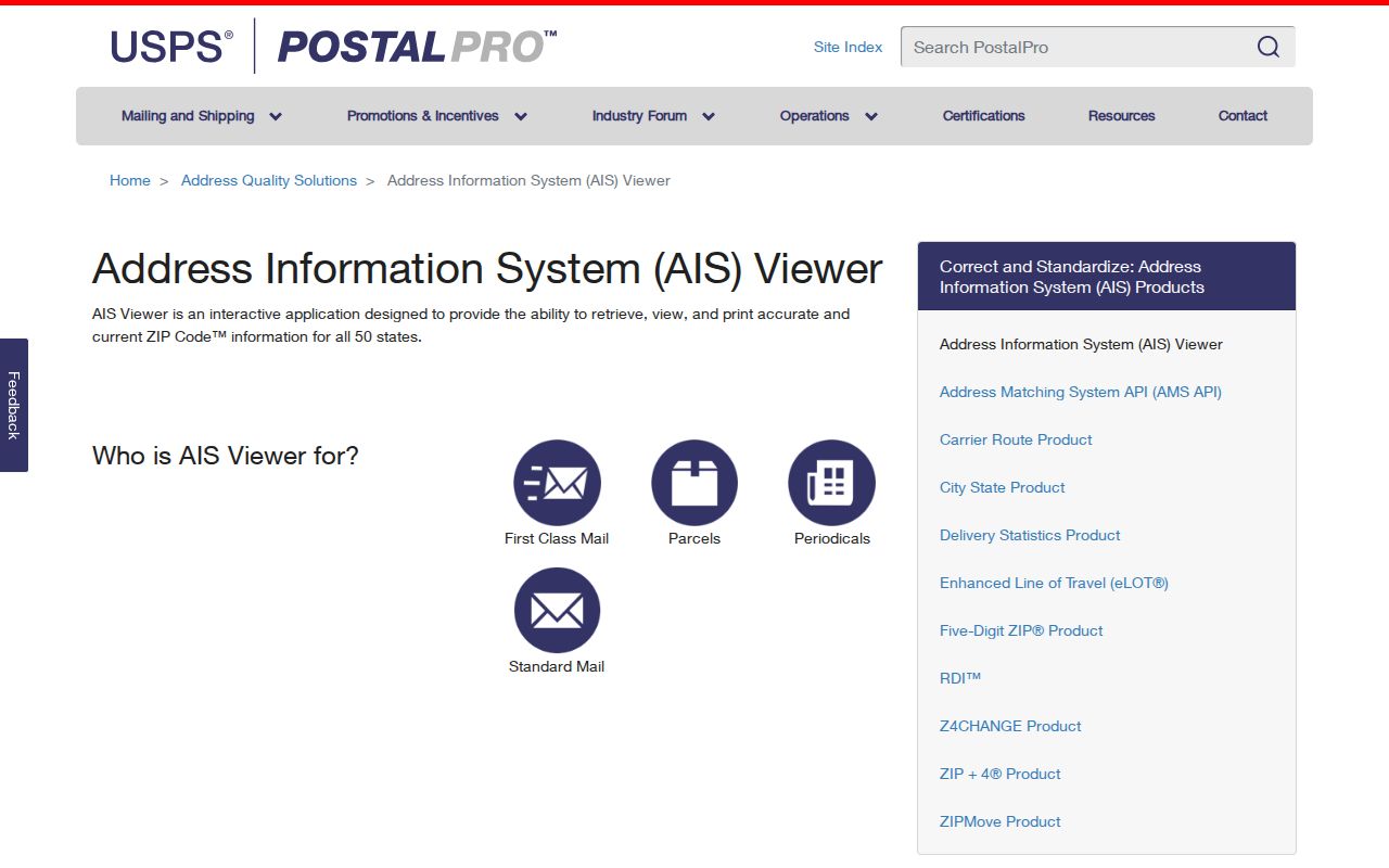
A current USPS response establishes delivery geography. It does not establish the parcel's owner, a household relationship, or the municipality's assessment jurisdiction.
Burlington County ZIP Map and Address Sources
The Burlington County GIS page lists parks, flood plains, roads and bridges, contours, historic USGS maps, and two property-viewer applications. At inspection, the Property Viewer Web Map and recommended Property Viewer Mapping Application were marked offline. NJGIN is the documented statewide fallback for parcel geometry, address points, road-centerline links, and alternate street names.
That fallback is most useful as a geography layer. It can turn an address into a municipality and parcel identifier, while the municipal assessor supplies parcel-card detail and PRESS supplies the recorded-document trail. County parcel edges may not align perfectly with adjacent counties, so a parcel close to a county line needs a jurisdiction check before a search is treated as complete.
The NJGIN address layer illustrates the statewide address data used for this first routing step.
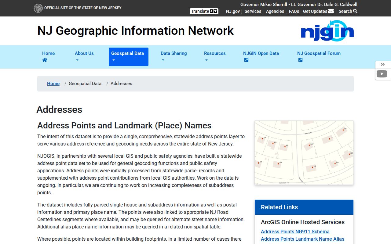
Address points and road links can help reconcile spelling or an alternate street name, but they do not turn a ZIP boundary into a municipal boundary.
When a Burlington County ZIP Does Not Match a Town
USPS ZIPs are delivery constructs. Census ZCTAs are statistical areas built to approximate ZIP geography, and they can be noncontiguous, represent a single institution, or be PO-box-only or unique. The distinction is important when a map or data table is used to choose a record custodian. Use USPS for the exact delivery address, use the municipality lookup and parcel data for legal geography, and use a ZCTA only for the statistical purpose it was designed to serve.
- ZIP and ZIP+4
- A five-digit delivery area can be refined by ZIP+4 for a smaller delivery segment. Neither replaces the municipality or parcel identifier.
- PO-box ZIP
- A postal label serving post-office boxes can differ from the geographic delivery area around the office.
- Unique ZIP
- A ZIP can be associated with one institution or other limited delivery pattern rather than a normal town area.
- Carrier route
- A delivery sequence used by USPS. It is useful for address quality, not a municipal or property boundary.
The Census ZCTA guidance provides the federal explanation for those limits.
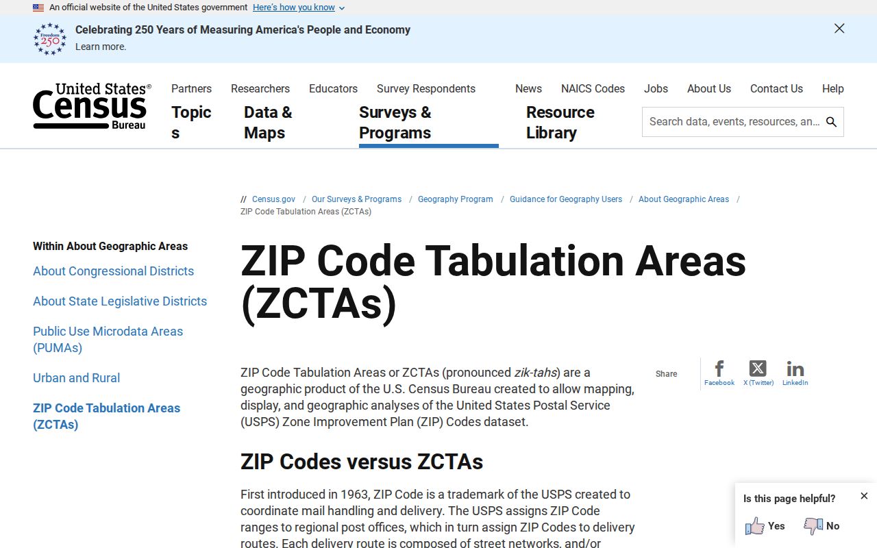
For Burlington County, a ZCTA map can be useful context, but it should not decide whether an Eastampton, Mount Holly, or Westampton record belongs to the right municipal file.
Burlington County ZIPs and Parcel Keys
New Jersey property research uses municipality plus block and lot, with a lot qualifier or PIN when needed. A legal description may instead use a subdivision reference or metes-and-bounds language. PRESS makes block-and-lot searching available for documents recorded on or after March 1, 2012. For 1965 through February 2012, PRESS uses owner-name searching; pre-1965 property images move to the County archive viewer and are searched by owner name.
That date split explains why a ZIP is only the beginning of a property path. Once an exact address is verified, use NJGIN or the municipal assessor for the parcel key. Then use the key in PRESS where the date permits, or use the recorded party name and the archive route for older material. A property owner, mailing address, and physical situs each answer different questions and should be labeled separately.
Burlington County ZIP Steps for Resident Records
A postal area cannot produce a single official directory of people. It can help narrow the next custodian. For a property question, the address leads to municipality, parcel key, assessor, and recorded documents. For a registration question, the official New Jersey voter search requires an exact match to the county record, and the Board of Elections is the human channel when the portal cannot answer a specific question. The full voter-list route is controlled by election law and redactions, not a public ZIP filter.
When no online index exposes a particular existing map, tax list, or election document, New Jersey's Open Public Records Act, N.J.S.A. 47:1A-1 et seq., provides a written-request route to the correct custodian. Describe the existing record, municipality, date span, and preferred delivery format. The ordinary response deadline is as soon as possible and no later than seven business days for available records, subject to the documented review and extension rules.
Once a ZIP has led to the right street and municipality, the Burlington County street directory has the separate parcel-by-parcel method for a named street.
Burlington County ZIP Code Directory Limits
Postal geography does not identify every person associated with an address. NJGIN-hosted parcel owner names are redacted under Daniel's Law, voter files protect addresses and identifiers for covered people, and the Address Confidentiality Program can provide a legal substitute address for eligible participants. A missing result can also reflect an incomplete index, a distinct mailing address, or a record that was never created. It should not be turned into a claim about a person's current location.
For a correction, preserve the source URL, record number, date, and indexed spelling, then contact the originating custodian. The assessor handles parcel-card corrections, the County Clerk handles recording or index questions, and the Board of Elections handles registration corrections. A ZIP label is a useful routing fact, not a substitute for those offices.